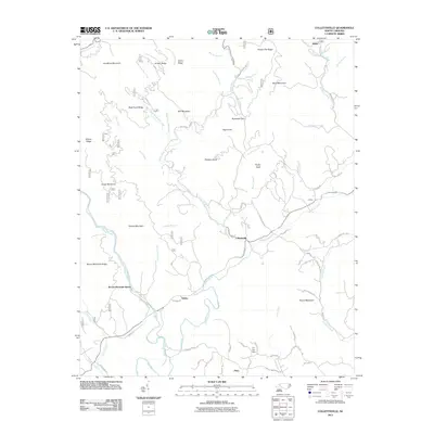
2011 Map of Collettsville
USGS Topo · Published 2011About this map
Johns River and Mulberry Creek converge near the settlement of Collettsville, forming the central drainage of this mountain landscape. The geography is defined by a dense network of named ridges and branches, including Bald Knob Ridge, Grassy Ridge, and Tarklin Ridge, which provided the framework for early roads and homesteads. Local family names are etched into the terrain via watercourses such as Eliza Estes Mill Creek, Larkins Estes Mill Creek, and Carroll Mill Creek, suggesting the historical importance of small-scale milling in these valleys. Small communities like Rufus, Adako, and Coffeys appear along the lower elevations, while more specialized sites such as Fox Dam and Brown Mountain Beach indicate the area's development for recreation and local utility. The presence of numerous branches and creeks highlights the intricate watershed that supported these Appalachian foothills communities.
Find a feature on this map
75 named features on this map. Tap any name to fly to it.
Don’t see what you’re looking for? This feature index may not catch every label — zoom into the map to look around manually.
Map Details
Editions of this 2011 Collettsville Map
This is the sole edition of this map. No revisions or reprints were ever made.
Other maps of this area

1893 · Cranberry
USGS Topo · 1:125,000

1895 · Cranberry
USGS Topo · 1:125,000

1899 · Cranberry
USGS Topo · 1:125,000

1902 · Cranberry
USGS Topo · 1:125,000

1905 · Morganton
USGS Topo · 1:125,000

1936 · Blowing Rock
USGS Topo · 1:48,000

1942 · Blowing Rock
USGS Topo · 1:62,500

1944 · Linville
USGS Topo · 1:62,500

1953 · Charlotte
USGS Topo · 1:250,000

1953 · Winston-Salem
USGS Topo · 1:250,000