
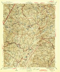
1944 Map of Linville
USGS Topo · Published 1944About this map
Grandfather Mountain and the high ridges of Beech Mountain dominate this mid-century landscape, reflecting a time when the high country of Avery, Watauga, and Caldwell Counties was defined by small mountain communities and institutional landmarks. The Grandfather Orphanage sits just outside Banner Elk, while the Hawshore Mtn Fire Tower watches over the southwestern forests. This 1944 edition, based on earlier surveys, details a network of rural education and worship, from Cranberry High School to St Johns Ch and Forest Home Ch. Along the Yonahlosee Road, the map traces the early development of Linville and Pineola, capturing the settlement pattern before modern expansion. Water sources like the Watauga River and Elk River are shown alongside smaller landmarks like Twisting Falls and Anthony Lake.
Find a feature on this map
140 named features on this map. Tap any name to fly to it.
Don’t see what you’re looking for? This feature index may not catch every label — zoom into the map to look around manually.
Map Details
Editions of this 1944 Linville Map
2 editions found
Other maps of this area

1891 · Roan Mountain
USGS Topo · 1:125,000

1893 · Cranberry
USGS Topo · 1:125,000

1894 · Roan Mountain
USGS Topo · 1:125,000

1895 · Cranberry
USGS Topo · 1:125,000

1899 · Cranberry
USGS Topo · 1:125,000

1900 · Mount Mitchell
USGS Topo · 1:125,000

1902 · Cranberry
USGS Topo · 1:125,000

1902 · Mount Mitchell
USGS Topo · 1:125,000

1904 · Roan Mountain
USGS Topo · 1:125,000

1905 · Morganton
USGS Topo · 1:125,000