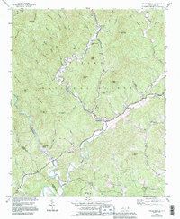
1993 Map of Collettsville
USGS Topo · Published 1996About this map
The Johns River winds through the heart of this landscape, carving a deep valley through the eastern reaches of the Pisgah National Forest. This 1993 revision, based on earlier mid-century surveys, reveals a community anchored by the settlement of Collettsville, where the Mulberry Creek and Johns River converge. The terrain is defined by a series of prominent ridges, including Eliza Ridge and Bald Knob Ridge, which descend toward the river's path.
Find a feature on this map
67 named features on this map. Tap any name to fly to it.
Don’t see what you’re looking for? This feature index may not catch every label — zoom into the map to look around manually.
Map Details
Editions of this 1993 Collettsville Map
This is the sole edition of this map. No revisions or reprints were ever made.
Other maps of this area

1893 · Cranberry
USGS Topo · 1:125,000

1895 · Cranberry
USGS Topo · 1:125,000

1899 · Cranberry
USGS Topo · 1:125,000

1902 · Cranberry
USGS Topo · 1:125,000

1905 · Morganton
USGS Topo · 1:125,000

1936 · Blowing Rock
USGS Topo · 1:48,000

1942 · Blowing Rock
USGS Topo · 1:62,500

1944 · Linville
USGS Topo · 1:62,500

1953 · Charlotte
USGS Topo · 1:250,000

1953 · Winston-Salem
USGS Topo · 1:250,000