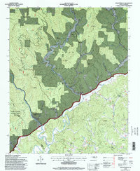
1994 Map of Collettsville
USGS Topo · Published 1998About this map
Pisgah National Forest dominates this mountain landscape, where the Johns River and its numerous tributaries carve deep valleys through the Blue Ridge terrain. The settlement of Collettsville serves as a focal point near the confluence of Franklin River and Johns River, surrounded by isolated rural communities like Adako and Rufus. The mapping reveals a high density of country houses of worship, including Green Valley Church, Confidence Church, and Conways Chapel, many with adjacent cemeteries that provide critical records for local family historians.
Find a feature on this map
47 named features on this map. Tap any name to fly to it.
Don’t see what you’re looking for? This feature index may not catch every label — zoom into the map to look around manually.
Map Details
Editions of this 1994 Collettsville Map
This is the sole edition of this map. No revisions or reprints were ever made.
Other maps of this area

1893 · Cranberry
USGS Topo · 1:125,000

1895 · Cranberry
USGS Topo · 1:125,000

1899 · Cranberry
USGS Topo · 1:125,000

1902 · Cranberry
USGS Topo · 1:125,000

1905 · Morganton
USGS Topo · 1:125,000

1936 · Blowing Rock
USGS Topo · 1:48,000

1942 · Blowing Rock
USGS Topo · 1:62,500

1944 · Linville
USGS Topo · 1:62,500

1953 · Charlotte
USGS Topo · 1:250,000

1953 · Winston-Salem
USGS Topo · 1:250,000