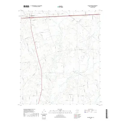
2019 Map of Colliers Creek
USGS Topo · Published 2019About this map
Marshall and the surrounding rural landscapes of Harrison County are captured in this modern survey, revealing a network of creeks and country roads south of the city center. The terrain is defined by its drainage system, where the waters of Colliers Cr and Eightmile Cr wind through the lowlands towards Quapaw Cr and Caddo Cr. This hydrological pattern has long influenced local settlement, with smaller communities like Gill established along the transit corridors that parallel these waterways.
Find a feature on this map
68 named features on this map. Tap any name to fly to it.
Don’t see what you’re looking for? This feature index may not catch every label — zoom into the map to look around manually.
Map Details
Editions of this 2019 Colliers Creek Map
This is the sole edition of this map. No revisions or reprints were ever made.
Other maps of this area

1943 · Waskom
USGS Topo · 1:62,500

1944 · Caddo Lake
USGS Topo · 1:62,500

1945 · Waskom
USGS Topo · 1:62,500

1946 · Caddo Lake
USGS Topo · 1:62,500

1956 · Tyler
USGS Topo · 1:250,000

1958 · Darco
USGS Topo · 1:62,500

1962 · Marshall West
USGS Topo · 1:24,000

1962 · Stricklin Springs
USGS Topo · 1:24,000

1962 · De Berry
USGS Topo · 1:24,000

1962 · Marshall East
USGS Topo · 1:24,000