
1962 Map of Stricklin Springs
USGS Topo · Published 1964About this map
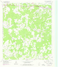
The Elysian Gas Field defines the industrial character of this corner of Harrison County, where active energy extraction meets traditional rural East Texas settlements. The landscape is marked by a complex network of pipelines and local landmarks like the Elysian Fields Lookout Tower and a Refinery near the northeastern boundary. Significant genealogy value is found in the clustered community centers of the early 1960s, including Stricklin Springs and the rural junction at Crossroads. Local life is anchored by established institutions such as the Elysian Fields Sch, and numerous spiritual sites like Mt Prospect Ch and Belview Ch. The topography is intricately carved by waterways including Butler Creek, Turkey Creek, and the West Fork Socagee Creek, which weave through a terrain heavily dotted with Oil Wells and gas infrastructure near Waskom.
Find a feature on this map
31 named features on this map. Tap any name to fly to it.
Don’t see what you’re looking for? This feature index may not catch every label — zoom into the map to look around manually.
Map Details
Editions of this 1962 Stricklin Springs Map
2 editions found
Other maps of this area

1943 · Waskom
USGS Topo · 1:62,500

1944 · Caddo Lake
USGS Topo · 1:62,500

1945 · Waskom
USGS Topo · 1:62,500

1946 · Caddo Lake
USGS Topo · 1:62,500

1956 · Tyler
USGS Topo · 1:250,000

1958 · Darco
USGS Topo · 1:62,500

1962 · De Berry
USGS Topo · 1:24,000
1962 · Panola
USGS Topo · 1:24,000
1962 · Waskom
USGS Topo · 1:24,000
1962 · Latex
USGS Topo · 1:24,000