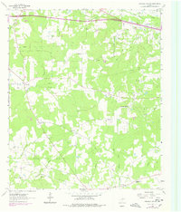
1962 Map of Stricklin Springs
USGS Topo · Published 1978About this map
Elysian Gas Field and Waskom Gas Field dominate the subsurface landscape of this Harrison County territory, marked by a dense network of pipelines and gas wells that reflect the region's energy economy during the mid-20th century. Above ground, the settlement pattern centers on scattered rural communities like Stricklin Springs and Crossroads, where social life appears anchored by local institutions such as the Elysian Fields Sch and Elysian Fields Lookout Tower.
Find a feature on this map
34 named features on this map. Tap any name to fly to it.
Don’t see what you’re looking for? This feature index may not catch every label — zoom into the map to look around manually.
Map Details
Editions of this 1962 Stricklin Springs Map
2 editions found
Other maps of this area

1943 · Waskom
USGS Topo · 1:62,500

1944 · Caddo Lake
USGS Topo · 1:62,500

1945 · Waskom
USGS Topo · 1:62,500

1946 · Caddo Lake
USGS Topo · 1:62,500

1956 · Tyler
USGS Topo · 1:250,000

1958 · Darco
USGS Topo · 1:62,500

1962 · Stricklin Springs
USGS Topo · 1:24,000

1962 · De Berry
USGS Topo · 1:24,000
1962 · Panola
USGS Topo · 1:24,000
1962 · Waskom
USGS Topo · 1:24,000