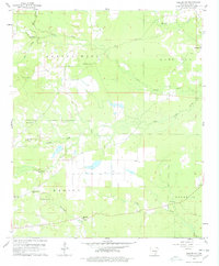
1960 Map of Collins NW
USGS Topo · Published 1978About this map
Spring Hill and Live Oak define the rural character of this corner of Drew County during the early 1960s. The landscape is marked by a high density of small community centers, visible through a network of country churches such as Old Union Ch, Jose Chapel, and Mt Zion Ch. The small settlement of Godfrey serves as a local point of reference, while the Monticello Airport occupies the southwestern portion of the sheet, reflecting the mid-century modernization of local transport. Numerous waterways, including Upper Cutoff Creek, Rat Creek, and Hurricane Creek, wind through the terrain, suggesting a landscape defined by its drainage patterns. Genealogists will find particular value in the clearly marked Shady Grove Cem and Piney Cem, which remain as permanent fixtures of the local heritage alongside their respective community meeting houses.
Find a feature on this map
23 named features on this map. Tap any name to fly to it.
Don’t see what you’re looking for? This feature index may not catch every label — zoom into the map to look around manually.
Map Details
Editions of this 1960 Collins NW Map
2 editions found
Other maps of this area

1935 · Feenyville
USGS Topo · 1:62,500

1935 · Cominto
USGS Topo · 1:62,500

1935 · Rotan
USGS Topo · 1:62,500

1953 · Greenwood
USGS Topo · 1:250,000

1956 · Greenwood
USGS Topo · 1:250,000

1960 · Selma
USGS Topo · 1:24,000

1960 · Collins NW
USGS Topo · 1:24,000

1960 · Collins
USGS Topo · 1:24,000

1960 · Collins
USGS Topo · 1:62,500

1960 · Cominto
USGS Topo · 1:24,000