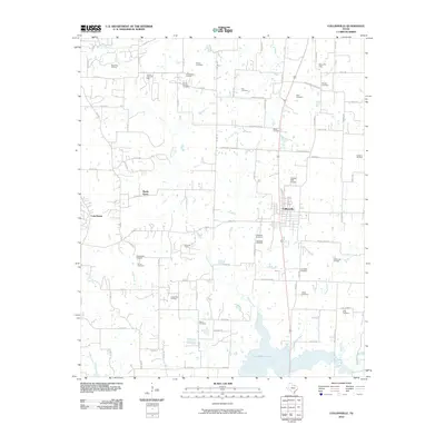
2010 Map of Collinsville
USGS Topo · Published 2010About this map
Collinsville serves as the central hub of this North Texas survey, where the grid of city streets meets the surrounding petroleum and agricultural landscape. The area is heavily defined by its natural and man-made water features, with the southern reaches occupied by the sprawling waters of Ray Roberts Lake and the western edge bordered by the residential development around Lake Kiowa. Numerous small watercourses, including Jordan Creek, Spring Creek, and Timber Creek, cut through the terrain, historically shaping the settlement patterns of the region.
Find a feature on this map
85 named features on this map. Tap any name to fly to it.
Don’t see what you’re looking for? This feature index may not catch every label — zoom into the map to look around manually.
Map Details
Editions of this 2010 Collinsville Map
This is the sole edition of this map. No revisions or reprints were ever made.
Other maps of this area

1901 · Denison
USGS Topo · 1:125,000

1902 · Gainesville
USGS Topo · 1:125,000

1943 · Gainesville
USGS Topo · 1:125,000

1954 · Sherman
USGS Topo · 1:250,000

1958 · Whitesboro
USGS Topo · 1:62,500

1958 · Sherman
USGS Topo · 1:250,000

1960 · Callisburg
USGS Topo · 1:24,000

1960 · Woodbine
USGS Topo · 1:24,000

1961 · Pilot Point
USGS Topo · 1:24,000
1961 · Marilee
USGS Topo · 1:24,000