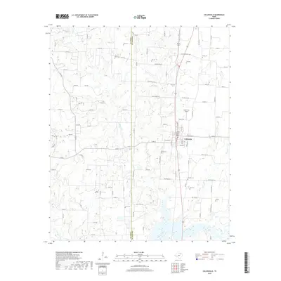
2019 Map of Collinsville
USGS Topo · Published 2019About this map
The North Texas town of Collinsville serves as the focal point of this 2019 survey, situated along the Cooke Co Grayson Co line. The landscape is defined by the dendritic drainage patterns of Timber Cr, Jordan Cr, and Spring Cr, which feed south toward the larger reservoir system. For genealogists and local historians, this map is exceptionally rich in burial sites, documenting over a dozen locations including Herod-Morris Cem, Ragsdale Cem, and the Mount Zion Cem.
Find a feature on this map
104 named features on this map. Tap any name to fly to it.
Don’t see what you’re looking for? This feature index may not catch every label — zoom into the map to look around manually.
Map Details
Editions of this 2019 Collinsville Map
This is the sole edition of this map. No revisions or reprints were ever made.
Other maps of this area

1901 · Denison
USGS Topo · 1:125,000

1902 · Gainesville
USGS Topo · 1:125,000

1943 · Gainesville
USGS Topo · 1:125,000

1954 · Sherman
USGS Topo · 1:250,000

1958 · Whitesboro
USGS Topo · 1:62,500

1958 · Sherman
USGS Topo · 1:250,000

1960 · Callisburg
USGS Topo · 1:24,000

1960 · Woodbine
USGS Topo · 1:24,000

1961 · Pilot Point
USGS Topo · 1:24,000
1961 · Marilee
USGS Topo · 1:24,000