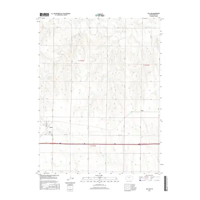
2015 Map of Collyer
USGS Topo · Published 2015About this map
Collyer and the surrounding plains of Trego County are defined by a rhythmic grid of agricultural roads and the winding paths of prairie waterways. This 2015 survey reveals a landscape where modern transit corridors like Old Hwy 40 run parallel to the historic settlement patterns of the High Plains. To the west of the town center, Saint Michaels Cem and Union Cem serve as important touchstones for local genealogy and history. The terrain is carved by the Saline River in the north and smaller tributaries such as Coyote Cr and Trego Cr to the east. These watercourses provide the only break in the strictly ordered township and range system, marked here by lettered routes from B Rd down to J Rd. The small community of Voda sits further east, marking another quiet node in this expansive rural network.
Find a feature on this map
26 named features on this map. Tap any name to fly to it.
Don’t see what you’re looking for? This feature index may not catch every label — zoom into the map to look around manually.
Map Details
Editions of this 2015 Collyer Map
This is the sole edition of this map. No revisions or reprints were ever made.
Other maps of this area

1893 · Ellis
USGS Topo · 1:125,000

1893 · Hill
USGS Topo · 1:125,000

1954 · Goodland
USGS Topo · 1:250,000

1955 · Great Bend
USGS Topo · 1:250,000

1955 · Scott City
USGS Topo · 1:250,000

1955 · Beloit
USGS Topo · 1:250,000

1956 · Goodland
USGS Topo · 1:250,000

1957 · Goodland
USGS Topo · 1:250,000

1957 · Great Bend
USGS Topo · 1:250,000

1958 · Great Bend
USGS Topo · 1:250,000