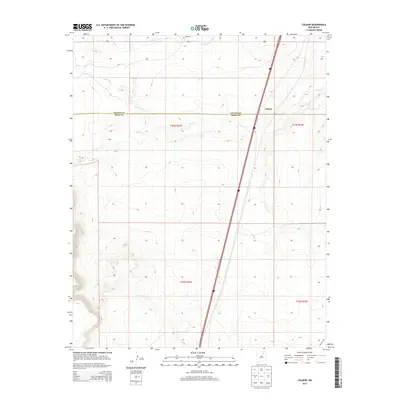
2013 Map of Colmor
USGS Topo · Published 2013About this map
Colmor sits at the high plains crossroads of northeastern New Mexico, where the landscape is defined by the sharp transition between Colfax and Mora counties. This 2013 survey documents the area's agricultural and transit infrastructure, featuring a network of irrigation works like the Charette Lake Canal that support the local rangeland. The terrain is etched by the drainage patterns of Sweetwater Cr and Ocate Cr, which flow through a region of scattered small settlements including Maes and Montoya. A significant historical element present on the sheet is a segment of the Santa Fe Trl in the southeast corner, marking the enduring path of one of the West's most famous trade routes across this high-altitude landscape.
Find a feature on this map
12 named features on this map. Tap any name to fly to it.
Don’t see what you’re looking for? This feature index may not catch every label — zoom into the map to look around manually.
Map Details
Editions of this 2013 Colmor Map
This is the sole edition of this map. No revisions or reprints were ever made.
Other maps of this area

1954 · Raton
USGS Topo · 1:250,000

1956 · Miami
USGS Topo · 1:62,500

1958 · Raton
USGS Topo · 1:250,000

1964 · Stony Lake
USGS Topo · 1:24,000

1964 · Wagon Mound
USGS Topo · 1:24,000

1964 · Alto De Hormiga
USGS Topo · 1:24,000

1964 · Colmor
USGS Topo · 1:24,000

1964 · Pinon Hills
USGS Topo · 1:24,000

1965 · Springer
USGS Topo · 1:24,000
1966 · La Chata Crater
USGS Topo · 1:24,000