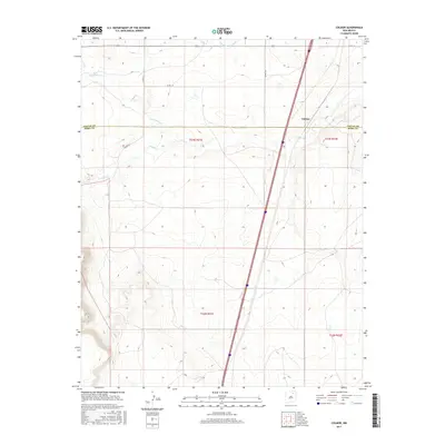
2017 Map of Colmor
USGS Topo · Published 2017About this map
Colmor sits as the primary settlement on this landscape, positioned along the north-south transport corridor that crosses the high plains of northeastern New Mexico. The boundary between Colfax Co and Mora Co bisects the region, marking a transition in local jurisdiction. The geography is defined by the drainage patterns of Sweetwater Cr and Ocate Cr, which cut through the terrain. Evidence of early 21st-century agricultural infrastructure is visible in the Charette Lake Canal, reflecting the ongoing importance of water management in this arid environment. Roads like Colmor Rd and Co Rd C-72 provide the necessary links between the scattered holdings and the central townsite. This survey offers a detailed record of the township and range divisions, including t23n r21e and t22n r22e, which have structured land ownership in this part of the state for generations.
Find a feature on this map
13 named features on this map. Tap any name to fly to it.
Don’t see what you’re looking for? This feature index may not catch every label — zoom into the map to look around manually.
Map Details
Editions of this 2017 Colmor Map
This is the sole edition of this map. No revisions or reprints were ever made.
Other maps of this area

1954 · Raton
USGS Topo · 1:250,000

1956 · Miami
USGS Topo · 1:62,500

1958 · Raton
USGS Topo · 1:250,000

1964 · Stony Lake
USGS Topo · 1:24,000

1964 · Wagon Mound
USGS Topo · 1:24,000

1964 · Alto De Hormiga
USGS Topo · 1:24,000

1964 · Colmor
USGS Topo · 1:24,000

1964 · Pinon Hills
USGS Topo · 1:24,000

1965 · Springer
USGS Topo · 1:24,000
1966 · La Chata Crater
USGS Topo · 1:24,000