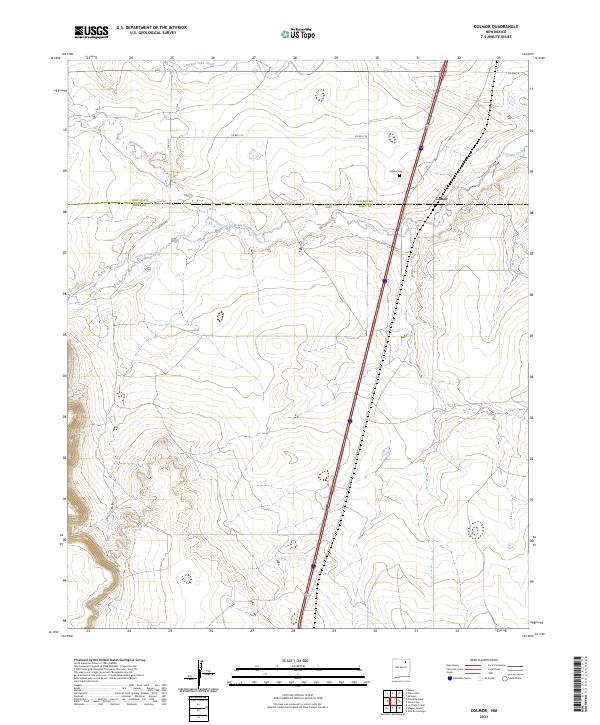
2023 Map of Colmor
USGS Topo · Published 2023About this map
Colmor sits as the primary point of settlement in this northern New Mexico landscape, positioned precisely where the high plains meet the transition into more broken terrain. The map captures a critical water management corridor, featuring the Charette Lake Canal to the north and the natural drainage systems of Sweetwater Creek and Ocate Creek. These waterways have long defined the agricultural potential and ranching boundaries of the region. Local history and genealogy researchers will find the Colmor Cem located just west of the main settlement, providing a vital point of reference for families tied to the early ranching history of both Colfax and Mora counties. The road network, including Colmor Rd and Co Rd C-72, traces established routes that connect these high-desert outposts, reflecting the enduring geography of the New Mexico interior.
Find a feature on this map
13 named features on this map. Tap any name to fly to it.
Don’t see what you’re looking for? This feature index may not catch every label — zoom into the map to look around manually.
Map Details
Editions of this 2023 Colmor Map
This is the sole edition of this map. No revisions or reprints were ever made.
Other maps of this area

1954 · Raton
USGS Topo · 1:250,000

1956 · Miami
USGS Topo · 1:62,500

1958 · Raton
USGS Topo · 1:250,000

1964 · Stony Lake
USGS Topo · 1:24,000

1964 · Wagon Mound
USGS Topo · 1:24,000

1964 · Alto De Hormiga
USGS Topo · 1:24,000

1964 · Colmor
USGS Topo · 1:24,000

1964 · Pinon Hills
USGS Topo · 1:24,000

1965 · Springer
USGS Topo · 1:24,000
1966 · La Chata Crater
USGS Topo · 1:24,000