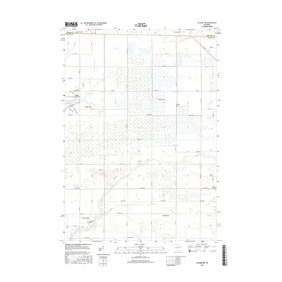
2015 Map of Coloma NW
USGS Topo · Published 2015About this map
Big Roche a Cri Cr meanders across this Adams County landscape, defining a terrain shaped by water management and rural development. The presence of several numbered basins, such as 9 Reservoir and 18 Reservoir, alongside the larger Lake Camelot, indicates a complex system of drainage and recreation. This 2015 survey reveals a distinct grid of local roads and avenues, including Apache Ave and Archer Ave, that section off the wetlands and plains. Local history is anchored by landmarks like Holliday Cem and geological features such as Owens Rock and Keystone Rock, which rise above the surrounding flats. The map also traces the northern boundaries where Adams Co meets Wood and Portage counties, illustrating the intersection of Fourteenmile Cr and Spring Br within these borderlands.
Find a feature on this map
59 named features on this map. Tap any name to fly to it.
Don’t see what you’re looking for? This feature index may not catch every label — zoom into the map to look around manually.
Map Details
Editions of this 2015 Coloma NW Map
This is the sole edition of this map. No revisions or reprints were ever made.
Other maps of this area

1955 · Green Bay
USGS Topo · 1:250,000

1957 · Wisconsin Rapids
USGS Topo · 1:48,000

1957 · Whiting
USGS Topo · 1:48,000

1958 · Arkdale
USGS Topo · 1:48,000

1958 · Coloma
USGS Topo · 1:48,000

1967 · Roche A Cri
USGS Topo · 1:24,000

1967 · Arkdale NE
USGS Topo · 1:24,000

1967 · Wisconsin Rapids
USGS Topo · 1:62,500

1968 · Coloma NW
USGS Topo · 1:24,000

1968 · Coloma SW
USGS Topo · 1:24,000