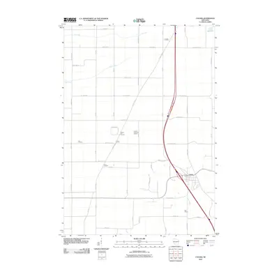
2010 Map of Coloma
USGS Topo · Published 2010About this map
Coloma and the nearby settlement of Coloma Corners anchor this Waushara County landscape, where agriculture and aviation meet the sandy central plains of Wisconsin. The village is positioned along a corridor of modern transit, yet it retains deep ties to its local history through several legacy burial grounds, including Hancock Cemetery, Pleasant Hill Cemetery, Fish Cemetery, and White Cemetery. These sites are distributed across a grid of rural avenues and county highways, providing a clear geography for genealogical research and family history mapping.
Find a feature on this map
41 named features on this map. Tap any name to fly to it.
Don’t see what you’re looking for? This feature index may not catch every label — zoom into the map to look around manually.
Map Details
Editions of this 2010 Coloma Map
This is the sole edition of this map. No revisions or reprints were ever made.
Other maps of this area

1955 · Green Bay
USGS Topo · 1:250,000

1957 · Madison
USGS Topo · 1:250,000

1958 · Coloma
USGS Topo · 1:48,000

1959 · Wautoma
USGS Topo · 1:48,000

1960 · Madison
USGS Topo · 1:250,000

1961 · Oxford
USGS Topo · 1:62,500

1961 · Montello
USGS Topo · 1:62,500

1968 · Coloma NW
USGS Topo · 1:24,000

1968 · Coloma SW
USGS Topo · 1:24,000

1968 · Coloma
USGS Topo · 1:24,000