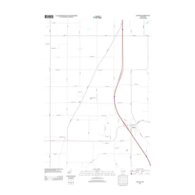
2013 Map of Coloma
USGS Topo · Published 2013About this map
Coloma serves as the primary hub of this Waushara County landscape, where the local street grid intersects with regional corridors. The village is flanked by essential aviation infrastructure, including the Coloma Municipal Airport and Rox Airport, reflecting its role as a central point for both commerce and transport in this part of Wisconsin. North of the main settlement lies Coloma Corners, a distinct named locality that highlights the area's rural development patterns. The physical geography is defined by seasonal watercourses like Dry Cr and the winding path of Carter Cr, while the northeast corner provides a glimpse of Deer Lake. These features, combined with the transition from Old Highway 21 to the modern bypass system, illustrate the evolution of the local transportation network and the persistence of early agricultural footprints.
Find a feature on this map
48 named features on this map. Tap any name to fly to it.
Don’t see what you’re looking for? This feature index may not catch every label — zoom into the map to look around manually.
Map Details
Editions of this 2013 Coloma Map
This is the sole edition of this map. No revisions or reprints were ever made.
Other maps of this area

1955 · Green Bay
USGS Topo · 1:250,000

1957 · Madison
USGS Topo · 1:250,000

1958 · Coloma
USGS Topo · 1:48,000

1959 · Wautoma
USGS Topo · 1:48,000

1960 · Madison
USGS Topo · 1:250,000

1961 · Oxford
USGS Topo · 1:62,500

1961 · Montello
USGS Topo · 1:62,500

1968 · Coloma NW
USGS Topo · 1:24,000

1968 · Coloma SW
USGS Topo · 1:24,000

1968 · Coloma
USGS Topo · 1:24,000