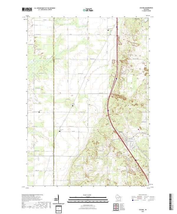
2022 Map of Coloma
USGS Topo · Published 2022About this map
The village of Coloma sits at a critical junction of transport and topography along the border of Adams and Waushara Counties. This survey shows a landscape defined by its rural cemetery network, including Hancock Cem, Fish Cem, Pleasant Hill Cem, and White Cem, which anchor the local genealogical record. The hydrology is characterized by ephemeral and winding systems like Dry Cr and Carter Cr, alongside Deer Lake in the northeastern corner near Hancock. Local road names such as Chilewski Dr and Busse Rd suggest deep-rooted family landholdings. The presence of Old Hwy 21 provides a trace of earlier transit corridors through this glacial sand plain region, reflecting the area's transition from early pioneer settlement to modern agricultural and thoroughfare use.
Find a feature on this map
45 named features on this map. Tap any name to fly to it.
Don’t see what you’re looking for? This feature index may not catch every label — zoom into the map to look around manually.
Map Details
Editions of this 2022 Coloma Map
This is the sole edition of this map. No revisions or reprints were ever made.
Other maps of this area

1955 · Green Bay
USGS Topo · 1:250,000

1957 · Madison
USGS Topo · 1:250,000

1958 · Coloma
USGS Topo · 1:48,000

1959 · Wautoma
USGS Topo · 1:48,000

1960 · Madison
USGS Topo · 1:250,000

1961 · Oxford
USGS Topo · 1:62,500

1961 · Montello
USGS Topo · 1:62,500

1968 · Coloma NW
USGS Topo · 1:24,000

1968 · Coloma SW
USGS Topo · 1:24,000

1968 · Coloma
USGS Topo · 1:24,000