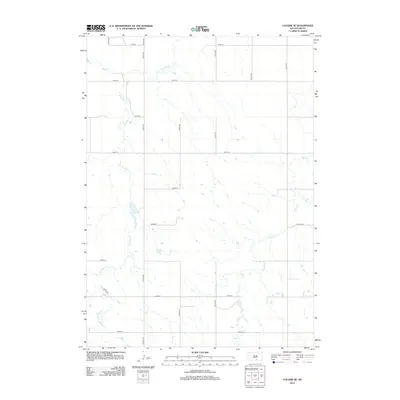
2012 Map of Colome SE
USGS Topo · Published 2012About this map
Bull Cr and its significant tributary, W Br Bull Cr, weave through this rural landscape in Tripp County, defining the drainage patterns of the high plains. The terrain is strictly partitioned by a systematic grid of section-line roads, a hallmark of the Great Plains' agricultural layout. Prominent north-south corridors like Vidock Rd and 331st Ave intersect with an orderly succession of east-west routes, including 278th St through 286th St. This 2012 survey illustrates a transition from local gravel and dirt paths to regional connectors such as Co Hwy-3 and Co Hwy-10a, reflecting the enduring reliance on this transportation network for ranching and farming operations long after the initial settlement of the region.
Find a feature on this map
20 named features on this map. Tap any name to fly to it.
Don’t see what you’re looking for? This feature index may not catch every label — zoom into the map to look around manually.
Map Details
Editions of this 2012 Colome SE Map
This is the sole edition of this map. No revisions or reprints were ever made.
Other maps of this area

1955 · Mitchell
USGS Topo · 1:250,000

1959 · Mitchell
USGS Topo · 1:250,000

1964 · Gregory
USGS Topo · 1:24,000

1964 · Dallas
USGS Topo · 1:24,000

1964 · Dallas NW
USGS Topo · 1:24,000

1971 · Colome
USGS Topo · 1:24,000

1971 · Dixon SW
USGS Topo · 1:24,000

1971 · Rattlesnake Butte East
USGS Topo · 1:24,000

1971 · Rattlesnake Butte West
USGS Topo · 1:24,000

1971 · Dixon
USGS Topo · 1:24,000