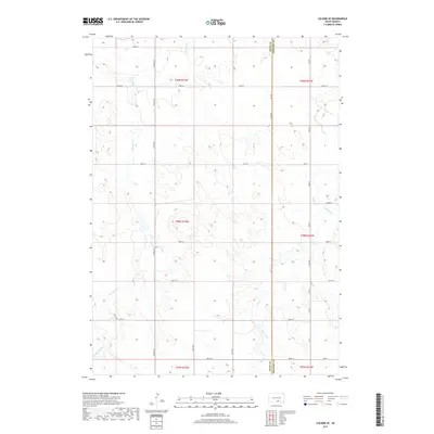
2017 Map of Colome SE
USGS Topo · Published 2017About this map
The boundary between Tripp Co and Gregory Co cuts vertically through this rural landscape in south-central South Dakota. The terrain is defined by the drainage network of the Bull Creek system, including the meandering paths of W Br Bull Cr, Bull Cr, and E Br Bull Cr. This 2017 survey illustrates the persistent township and range grid that governs the region's organization, with section lines marked by a network of gravel and local roads such as Viaduct Rd and 332nd Ave. The map reflects a classic Great Plains agricultural pattern, where infrequent watercourses provide the primary natural breaks in an otherwise structured landscape of section-line roads and wide-open acreage. Researchers can observe how modern county roads like Co Rd 3 continue to follow these historical survey lines.
Find a feature on this map
33 named features on this map. Tap any name to fly to it.
Don’t see what you’re looking for? This feature index may not catch every label — zoom into the map to look around manually.
Map Details
Editions of this 2017 Colome SE Map
This is the sole edition of this map. No revisions or reprints were ever made.
Other maps of this area

1955 · Mitchell
USGS Topo · 1:250,000

1959 · Mitchell
USGS Topo · 1:250,000

1964 · Gregory
USGS Topo · 1:24,000

1964 · Dallas
USGS Topo · 1:24,000

1964 · Dallas NW
USGS Topo · 1:24,000

1971 · Colome
USGS Topo · 1:24,000

1971 · Dixon SW
USGS Topo · 1:24,000

1971 · Rattlesnake Butte East
USGS Topo · 1:24,000

1971 · Rattlesnake Butte West
USGS Topo · 1:24,000

1971 · Dixon
USGS Topo · 1:24,000