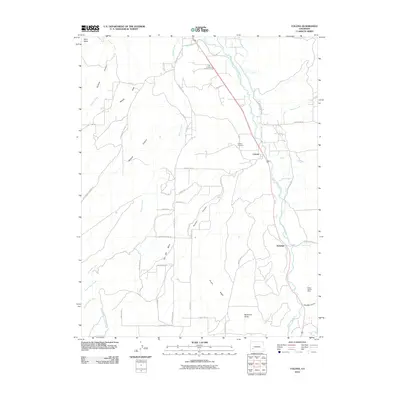
2010 Map of Colona
USGS Topo · Published 2010About this map
The Uncompahgre River valley serves as the central artery for this portion of Ouray County, where the settlement of Colona and the Colona Cemetery sit along the corridor of the river and irrigation works like the McDonald Ditch. The landscape transitions sharply from the fertile river bottom to the high elevations of Sims Mesa and Log Hill Mesa, cut by drainage systems including Horsefly Creek and Dolores Creek.
Find a feature on this map
50 named features on this map. Tap any name to fly to it.
Don’t see what you’re looking for? This feature index may not catch every label — zoom into the map to look around manually.
Map Details
Editions of this 2010 Colona Map
This is the sole edition of this map. No revisions or reprints were ever made.
Other maps of this area

1902 · Ouray
USGS Topo · 1:62,500

1904 · Ouray
USGS Topo · 1:62,500

1909 · Montrose
USGS Topo · 1:125,000

1911 · Montrose
USGS Topo · 1:125,000

1956 · Montrose
USGS Topo · 1:250,000

1957 · Cerro Summit
USGS Topo · 1:24,000

1959 · Montrose
USGS Topo · 1:250,000

1960 · Montrose
USGS Topo · 1:250,000
1962 · Montrose East
USGS Topo · 1:24,000
1962 · Montrose West
USGS Topo · 1:24,000