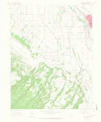
1962 Map of Montrose West
USGS Topo · Published 1966About this map
The city of Montrose and its surrounding agricultural valley are defined by a complex network of irrigation and infrastructure in the early 1960s. The Uncompahgre River flows through the northeast, paralleled by the tracks of the Denver and Rio Grande Western RR. Vital water management systems, including the Montrose and Delta Canal and West Canal, cut across the landscape to support farms near the settlement of Oak Grove.
Find a feature on this map
34 named features on this map. Tap any name to fly to it.
Don’t see what you’re looking for? This feature index may not catch every label — zoom into the map to look around manually.
Map Details
Editions of this 1962 Montrose West Map
4 editions found
Other maps of this area

1909 · Montrose
USGS Topo · 1:125,000

1911 · Montrose
USGS Topo · 1:125,000

1955 · Olathe
USGS Topo · 1:24,000

1955 · Red Rock Canyon
USGS Topo · 1:24,000

1956 · Montrose
USGS Topo · 1:250,000

1956 · Moab
USGS Topo · 1:250,000

1959 · Moab
USGS Topo · 1:250,000

1959 · Montrose
USGS Topo · 1:250,000

1960 · Montrose
USGS Topo · 1:250,000

1960 · Moab
USGS Topo · 1:250,000