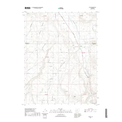
2019 Map of Colona
USGS Topo · Published 2019About this map
The Uncompahgre River valley serves as the primary corridor for settlement and transit in this southwestern Colorado landscape, where the town of Colona sits near the crossing of the Montrose and Ouray county line. The topography is defined by significant elevation shifts between the river basin and high features like Log Hill Mesa, Pinion Ridge, and the Uncompahgre Plateau. Irrigation infrastructure, critical to the region's agricultural history, is visible through the Mc Donald Ditch and W Canal.
Find a feature on this map
75 named features on this map. Tap any name to fly to it.
Don’t see what you’re looking for? This feature index may not catch every label — zoom into the map to look around manually.
Map Details
Editions of this 2019 Colona Map
This is the sole edition of this map. No revisions or reprints were ever made.
Other maps of this area

1902 · Ouray
USGS Topo · 1:62,500

1904 · Ouray
USGS Topo · 1:62,500

1909 · Montrose
USGS Topo · 1:125,000

1911 · Montrose
USGS Topo · 1:125,000

1956 · Montrose
USGS Topo · 1:250,000

1957 · Cerro Summit
USGS Topo · 1:24,000

1959 · Montrose
USGS Topo · 1:250,000

1960 · Montrose
USGS Topo · 1:250,000
1962 · Montrose East
USGS Topo · 1:24,000
1962 · Montrose West
USGS Topo · 1:24,000