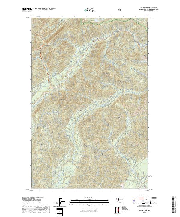
2023 Map of Colonel Bob
USGS Topo · Published 2023About this map
The Olympic Mountains dominate this landscape within the Colonel Bob Wilderness and Olympic National Forest. The map centers on the high elevation of Colonel Bob, where the Colonel Bob-Summit Trl provides access to dramatic peaks including Gibson Peak and Moonlight Dome. This is a terrain defined by its complex hydrology, where the West Fork Humptulips River and the West Branch Wynoochee River originate among the steep slopes of Quinault Ridge. To the south, the drainages of the Middle Fork Big Creek and West Fork Big Creek flow toward Fitzgerald Peak, illustrating the watershed divides of the southwestern Olympics. The inclusion of primitive routes like the West Fork Humptulips Trl and Petes Creek trail systems highlights the area's preservation for backcountry recreation and wilderness conservation.
Find a feature on this map
34 named features on this map. Tap any name to fly to it.
Don’t see what you’re looking for? This feature index may not catch every label — zoom into the map to look around manually.
Map Details
Editions of this 2023 Colonel Bob Map
This is the sole edition of this map. No revisions or reprints were ever made.
Other maps of this area

1921 · Quinault Lake
USGS Topo · 1:62,500

1921 · Satsop
USGS Topo · 1:62,500

1947 · Mt Christie
USGS Topo · 1:62,500

1950 · Mt Christie
USGS Topo · 1:62,500

1955 · Grisdale
USGS Topo · 1:62,500

1955 · Quinault Lake
USGS Topo · 1:62,500

1956 · Kloochman Rock
USGS Topo · 1:62,500

1958 · Seattle
USGS Topo · 1:250,000

1962 · Seattle
USGS Topo · 1:250,000
1988 · Shelton
USGS Topo · 1:100,000