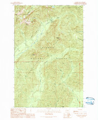
1990 Map of Colonel Bob
USGS Topo · Published 1990About this map
The high peaks of the Quinault Ridge and Olympic Ridge dominate this corner of the Olympic Peninsula. As of 1990, the landscape is defined by the sharp boundaries between the Olympic National Park, the Colonel Bob Wilderness, and the Olympic National Forest. The complex hydrology of the region is evident in the headwaters of the Humptulips River, which splits into its West Fork and Middle Fork as it drains the steep terrain.
Find a feature on this map
27 named features on this map. Tap any name to fly to it.
Don’t see what you’re looking for? This feature index may not catch every label — zoom into the map to look around manually.
Map Details
Editions of this 1990 Colonel Bob Map
This is the sole edition of this map. No revisions or reprints were ever made.
Other maps of this area

1921 · Quinault Lake
USGS Topo · 1:62,500

1921 · Satsop
USGS Topo · 1:62,500

1947 · Mt Christie
USGS Topo · 1:62,500

1950 · Mt Christie
USGS Topo · 1:62,500

1955 · Grisdale
USGS Topo · 1:62,500

1955 · Quinault Lake
USGS Topo · 1:62,500

1956 · Kloochman Rock
USGS Topo · 1:62,500

1958 · Seattle
USGS Topo · 1:250,000

1962 · Seattle
USGS Topo · 1:250,000
1988 · Shelton
USGS Topo · 1:100,000