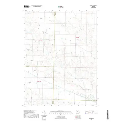
2017 Map of Colony
USGS Topo · Published 2017About this map
The North Fabius River and Little Wyaconda River systems define this rural landscape where four Missouri counties—Scotland, Clark, Knox, and Lewis—converge. Small agrarian settlements such as Colony and Fairmont anchor the township lines, connected by a network of state highways and local routes like Ella Ewing Rd and Raccoon Rd. For genealogists and local historians, the sheet is particularly valuable for identifying isolated family and community burial grounds, including Sutter Cem, Standiford Cem, and Bailey Cem.
Find a feature on this map
46 named features on this map. Tap any name to fly to it.
Don’t see what you’re looking for? This feature index may not catch every label — zoom into the map to look around manually.
Map Details
Editions of this 2017 Colony Map
This is the sole edition of this map. No revisions or reprints were ever made.
Other maps of this area

1903 · Kahoka
USGS Topo · 1:125,000

1903 · Edina
USGS Topo · 1:125,000

1950 · Neeper
USGS Topo · 1:24,000

1950 · Williamstown
USGS Topo · 1:24,000

1950 · Medill
USGS Topo · 1:24,000

1950 · Colony
USGS Topo · 1:24,000

1951 · Colony
USGS Topo · 1:24,000

1951 · Neeper
USGS Topo · 1:24,000

1951 · Medill
USGS Topo · 1:24,000
1951 · Williamstown
USGS Topo · 1:24,000