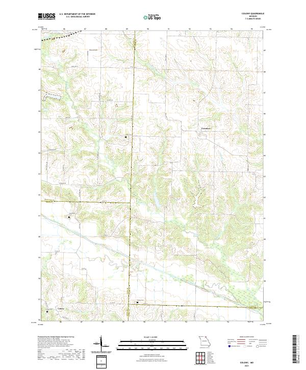
2021 Map of Colony
USGS Topo · Published 2021About this map
Fairmont and Colony anchor this rural landscape in Northeast Missouri, where the borders of Scotland, Clark, Knox, and Lewis counties converge. The terrain is defined by the branching drainages of the North Fabius River and the Little Wyaconda River, creating a network of ridges and bottoms. Local history is preserved in several small burial grounds scattered across the townships, including Sutter Cem, Standiford Cem, Bailey Cem, and Colony Cem. Transportation follows a mix of established state routes like State Hwy K and a geometric grid of rural roads such as Rainbow Rd and Sycamore Ln. The presence of Hines Airport in the northern reaches suggests the continued importance of regional connectivity in this agricultural heartland, while smaller waterways like Bear Cr and Vernon Br continue to shape the local topography and property boundaries.
Find a feature on this map
41 named features on this map. Tap any name to fly to it.
Don’t see what you’re looking for? This feature index may not catch every label — zoom into the map to look around manually.
Map Details
Editions of this 2021 Colony Map
This is the sole edition of this map. No revisions or reprints were ever made.
Other maps of this area

1903 · Kahoka
USGS Topo · 1:125,000

1903 · Edina
USGS Topo · 1:125,000

1950 · Neeper
USGS Topo · 1:24,000

1950 · Williamstown
USGS Topo · 1:24,000

1950 · Medill
USGS Topo · 1:24,000

1950 · Colony
USGS Topo · 1:24,000

1951 · Colony
USGS Topo · 1:24,000

1951 · Neeper
USGS Topo · 1:24,000

1951 · Medill
USGS Topo · 1:24,000
1951 · Williamstown
USGS Topo · 1:24,000