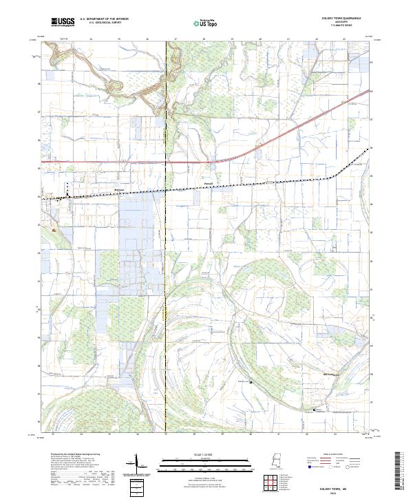
2024 Map of Colony Town
USGS Topo · Published 2024About this map
The delta lowlands along the boundary of Sunflower and Leflore counties reveal a landscape defined by meandering watercourses and agrarian settlements. The Quiver River and Muddy Bayou snake through the northern sections, while the southern reaches are marked by distinct oxbow and brake formations like Jug Lake, Cat Lake, and Cordy Brake. These water bodies are remnants of a complex hydraulic system that has long dictated the placement of roads and homesteads in the region.
Find a feature on this map
55 named features on this map. Tap any name to fly to it.
Don’t see what you’re looking for? This feature index may not catch every label — zoom into the map to look around manually.
Map Details
Editions of this 2024 Colony Town Map
This is the sole edition of this map. No revisions or reprints were ever made.
Other maps of this area

1931 · Schlater
USGS Topo · 1:48,000

1934 · Cleveland
USGS Topo · 1:62,500

1934 · Schlater
USGS Topo · 1:62,500

1939 · Schlater
USGS Topo · 1:62,500

1940 · Baird
USGS Topo · 1:62,500

1940 · Cleveland
USGS Topo · 1:62,500

1953 · Greenwood
USGS Topo · 1:250,000

1956 · Greenwood
USGS Topo · 1:250,000

1961 · Mossy Lake
USGS Topo · 1:62,500
1961 · Schlater
USGS Topo · 1:62,500