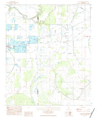
1983 Map of Colony Town
USGS Topo · Published 1984About this map
The alluvial plains of the Mississippi Delta, specifically along the Sunflower and Leflore County line, are defined here by an intricate web of water and aquaculture. This landscape is dominated by the Quiver River and a multitude of oxbow lakes and bayous, including McCoy Lake, Jug Lake, and Onemile Lake. The map reveals a highly engineered agricultural environment, where numerous fish farms and wells support the local economy around Moorhead and Mattoon.
Find a feature on this map
23 named features on this map. Tap any name to fly to it.
Don’t see what you’re looking for? This feature index may not catch every label — zoom into the map to look around manually.
Map Details
Editions of this 1983 Colony Town Map
This is the sole edition of this map. No revisions or reprints were ever made.
Other maps of this area

1931 · Schlater
USGS Topo · 1:48,000

1934 · Cleveland
USGS Topo · 1:62,500

1934 · Schlater
USGS Topo · 1:62,500

1939 · Schlater
USGS Topo · 1:62,500

1940 · Baird
USGS Topo · 1:62,500

1940 · Cleveland
USGS Topo · 1:62,500

1953 · Greenwood
USGS Topo · 1:250,000

1956 · Greenwood
USGS Topo · 1:250,000

1961 · Mossy Lake
USGS Topo · 1:62,500
1961 · Schlater
USGS Topo · 1:62,500