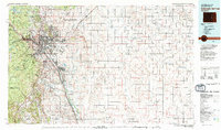
1981 Map of Colorado Springs
USGS Topo · Published 1981About this map
The growing metropolitan footprint of Colorado Springs and its surrounding military installations dominate the western portion of this 1981 survey. To the north, the United States Air Force Academy occupies the foothills below Black Forest, while Peterson Air Force Base and the Municipal Airport lie east of the city. The massive installation at Fort Carson extends southward, neighboring the communities of Security and Widefield.
Find a feature on this map
54 named features on this map. Tap any name to fly to it.
Don’t see what you’re looking for? This feature index may not catch every label — zoom into the map to look around manually.
Map Details
Editions of this 1981 Colorado Springs Map
2 editions found
Other maps of this area

1889 · Canon City
USGS Topo · 1:125,000

1889 · Sanborn
USGS Topo · 1:125,000

1891 · Sanborn
USGS Topo · 1:125,000

1891 · Catlin
USGS Topo · 1:125,000

1891 · Pueblo
USGS Topo · 1:125,000

1891 · Nepesta
USGS Topo · 1:125,000

1891 · Limon
USGS Topo · 1:125,000

1892 · Limon
USGS Topo · 1:125,000

1892 · Canon City
USGS Topo · 1:125,000

1893 · Nepesta
USGS Topo · 1:125,000