
2021 Map of Colton
USGS Topo · Published 2021About this map
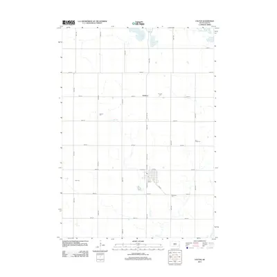
Colton serves as the central hub of this agricultural landscape in northwestern Minnehaha County, where the street grid of S Main Ave and E 1st St meets the winding path of Colton Cr. This area is part of the Coteau des Prairies, a high plateau between the Big Sioux and James River valleys, characterized here by a dense concentration of rural burial grounds. Genealogists will find a high density of historical markers, including Bethania Cem, Saint Joseph Cem, and Saint Ansgar Cem, which are scattered among the section lines north of the city. To the north, the small settlement of Huntimer is situated near Spring Lake, while the southern reaches are marked by the presence of Taopi Cem and Minnehaha Cem, documenting the long-standing community roots established along the county borders with Lake and Moody counties.
Find a feature on this map
63 named features on this map. Tap any name to fly to it.
Don’t see what you’re looking for? This feature index may not catch every label — zoom into the map to look around manually.
Map Details
Editions of this 2021 Colton Map
This is the sole edition of this map. No revisions or reprints were ever made.
Historical Maps of Colton Through Time
5 maps found
Featured Locations
- Chester Township, SD
- Lynn Township, SD
- Taopi Township, SD
- Colton, Taopi Township
- Huntimer, Taopi Township