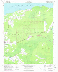
1953 Map of Columbia East
USGS Topo · Published 1977About this map
Albemarle Sound defines the northern coastline of this survey, where the small community of Soundside and the Dewey Pier mark the interface between the land and the vast coastal waters. Inland, the town of Columbia serves as the regional anchor, surrounded by a landscape of drainage canals and agricultural plots that intersect the wetlands of Big Savanna and Cranberry Island. The map records a rural network of small settlements and faith centers, including Newfoundland, Pleasant View, and Malachi Chapel.
Find a feature on this map
24 named features on this map. Tap any name to fly to it.
Don’t see what you’re looking for? This feature index may not catch every label — zoom into the map to look around manually.
Map Details
Editions of this 1953 Columbia East Map
2 editions found
Other maps of this area

1906 · Hertford
USGS Topo · 1:62,500

1940 · Hertford
USGS Topo · 1:62,500

1940 · Wade Point
USGS Topo · 1:62,500

1943 · Wade Point
USGS Topo · 1:62,500

1943 · Columbia
USGS Topo · 1:125,000

1948 · Wade Point
USGS Topo · 1:62,500

1953 · Norfolk
USGS Topo · 1:250,000

1953 · Columbia East
USGS Topo · 1:24,000

1953 · Scotia
USGS Topo · 1:24,000

1953 · Columbia West
USGS Topo · 1:24,000