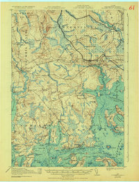
1921 Map of Columbia Falls
USGS Topo · Published 1932About this map
The coastal economy of Washington County, Maine, is intricately detailed in this survey, showcasing a landscape defined by its connection to the sea and the Maine Central railroad. Along the ragged Atlantic coastline, the maritime centers of Jonesport and Beals sit near the Moosabec Reach, while inland settlements like Columbia Falls and Whitneyville occupy the banks of the Machias River and Pleasant River. The map reveals a dense network of local education and family landmarks, including the White School, Monsapec School, and the Batson School.
Find a feature on this map
134 named features on this map. Tap any name to fly to it.
Don’t see what you’re looking for? This feature index may not catch every label — zoom into the map to look around manually.
Map Details
Editions of this 1921 Columbia Falls Map
4 editions found
Other maps of this area

1902 · Cherryfield
USGS Topo · 1:62,500

1904 · Cherryfield
USGS Topo · 1:62,500

1904 · Petit Manan
USGS Topo · 1:62,500

1918 · Machias
USGS Topo · 1:62,500

1921 · Great Wass Island
USGS Topo · 1:62,500

1921 · Columbia Falls
USGS Topo · 1:62,500

1921 · Columbia Falls
USGS Topo · 1:62,500

1941 · Columbia Falls
USGS Topo · 1:62,500

1941 · Machias
USGS Topo · 1:62,500

1941 · Wesley
USGS Topo · 1:62,500