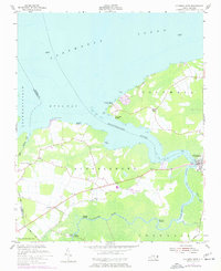
1953 Map of Columbia West
USGS Topo · Published 1977About this map
The Scuppernong River winds through the coastal lowlands of Tyrrell County, defining the local geography as it flows toward Bull Bay and the vast Albemarle Sound. This mid-century survey reveals a landscape deeply connected to the water, where numerous landings such as River Neck Landing, Back Landing, and Simmons Landing once served as vital access points for transportation and commerce. The settlement of Columbia sits at a critical bend in the river, anchoring the eastern portion of the map near the Scuppernong township.
Find a feature on this map
29 named features on this map. Tap any name to fly to it.
Don’t see what you’re looking for? This feature index may not catch every label — zoom into the map to look around manually.
Map Details
Editions of this 1953 Columbia West Map
2 editions found
Other maps of this area

1906 · Hertford
USGS Topo · 1:62,500

1940 · Hertford
USGS Topo · 1:62,500

1940 · Wade Point
USGS Topo · 1:62,500

1943 · Wade Point
USGS Topo · 1:62,500

1943 · Columbia
USGS Topo · 1:125,000

1948 · Wade Point
USGS Topo · 1:62,500

1953 · Norfolk
USGS Topo · 1:250,000

1953 · Columbia East
USGS Topo · 1:24,000

1953 · Scotia
USGS Topo · 1:24,000

1953 · Columbia West
USGS Topo · 1:24,000