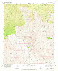
1969 Map of Columbia
USGS Topo · Published 1973About this map
Bradshaw Mountains mineral wealth is evident throughout this late 1960s survey, centered on the settlement of Columbia. The landscape is a network of industrial sites and small claims, including the Red Star Mine, Pero Bonito Mine, and the Hardtimes Mine Ruins. The presence of Allen Mill and the Gold Spring Mine suggests a localized economy built on extraction, supported by isolated outposts like Milk Ranch and Champie Ranch.
Find a feature on this map
63 named features on this map. Tap any name to fly to it.
Don’t see what you’re looking for? This feature index may not catch every label — zoom into the map to look around manually.
Map Details
Editions of this 1969 Columbia Map
4 editions found
Other maps of this area

1887 · Prescott
USGS Topo · 1:250,000

1892 · Prescott
USGS Topo · 1:250,000

1903 · Bradshaw Mountains
USGS Topo · 1:125,000

1947 · Crown King
USGS Topo · 1:62,500

1947 · Bumblebee
USGS Topo · 1:62,500

1948 · Bumblebee
USGS Topo · 1:63,360

1948 · Crown King
USGS Topo · 1:63,360

1950 · Crown King
USGS Topo · 1:62,500

1950 · Bumblebee
USGS Topo · 1:62,500

1950 · Prescott
USGS Topo · 1:250,000