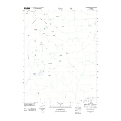
2011 Map of Columbine Pass
USGS Topo · Published 2011About this map
The Needle Mountains dominate this high-elevation landscape, where sharp peaks and high-alpine basins define the topography of La Plata County. In the northwestern corner, the Chicago Basin is surrounded by some of the region's highest points, including Windom Peak, Mount Eolus, and Jupiter Mountain. This early 21st-century survey reveals a history of resource extraction reaching into these remote heights, evidenced by the Aetna Mine and the Vallecito Group Mine situated near the headwaters of Vallecito Creek. Water management for the region is noted through features like the Durango Reservoir Number 1 and its associated Durango Number 1 Dam, while the lower elevations show the transition from steep gulches like Missouri Gulch to the broader expanse of Silver Mesa and Endlich Mesa.
Find a feature on this map
62 named features on this map. Tap any name to fly to it.
Don’t see what you’re looking for? This feature index may not catch every label — zoom into the map to look around manually.
Map Details
Editions of this 2011 Columbine Pass Map
This is the sole edition of this map. No revisions or reprints were ever made.
Other maps of this area

1900 · Needle Mountains
USGS Topo · 1:62,500

1902 · Needle Mountains
USGS Topo · 1:62,500

1905 · San Cristobal
USGS Topo · 1:125,000

1907 · San Cristobal
USGS Topo · 1:125,000

1908 · Ignacio
USGS Topo · 1:125,000

1924 · Ignacio
USGS Topo · 1:125,000

1924 · Pagosa Springs
USGS Topo · 1:125,000

1927 · Pagosa Springs
USGS Topo · 1:125,000

1945 · Durango
USGS Topo · 1:250,000

1953 · Durango
USGS Topo · 1:250,000