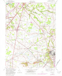
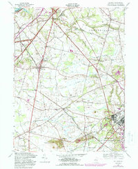
1957 Map of Columbus
USGS Topo · Published 1982About this map
Bordentown and the surrounding agricultural townships of Burlington County are defined by a complex network of brooks and legacy homesteads in this mid-century survey. The landscape transitions from the riverfront at the Delaware R toward the sprawling grounds of the Fort Dix Military Reservation in the southeast. Notable local institutions like the Columbus Civic and Athletic Club and the Mount Holly Speedway appear alongside quiet rural landmarks such as St Andrews Ch and the Wallace Mill. The infrastructure of the era is clearly visible, with the New Jersey Turnpike cutting through the terrain and the Penn Central rail lines connecting established settlements. Smaller hamlets like Mansfield Square, Juliustown, and Jobstown retain their historic footprints amidst the rolling topography leading up to Arneys Mount, the most prominent elevation in the immediate area.
Find a feature on this map
47 named features on this map. Tap any name to fly to it.
Don’t see what you’re looking for? This feature index may not catch every label — zoom into the map to look around manually.
Map Details
Editions of this 1957 Columbus Map
5 editions found
Other maps of this area

1888 · Bordentown
USGS Topo · 1:62,500

1888 · Pemberton
USGS Topo · 1:62,500

1888 · Mount Holly
USGS Topo · 1:62,500

1890 · Burlington
USGS Topo · 1:62,500

1893 · Bordentown
USGS Topo · 1:62,500

1893 · Burlington
USGS Topo · 1:62,500

1894 · Pemberton
USGS Topo · 1:62,500

1894 · Mount Holly
USGS Topo · 1:62,500

1898 · Pemberton
USGS Topo · 1:62,500

1898 · Mount Holly
USGS Topo · 1:62,500
Featured Places
- Bordentown Township, NJ
- Mansfield Township, NJ
- Chesterfield Township, NJ
- Eastampton Township, NJ
- Springfield Township, NJ