
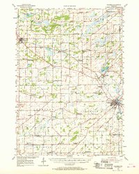
1955 Map of Columbus
USGS Topo · Published 1956About this map
The Crawfish River winds through this mid-1950s landscape, anchoring a rural Wisconsin region defined by its productive farmland and established townships. The terrain is marked by numerous small-scale drainage features like Jennings Creek and Robbins Creek, feeding into larger waterways such as the North Branch and Beaver Creek. Settlement patterns are concentrated along the Chicago Milwaukee St Paul and Pacific railroad, which links the communities of Rio, Doylestown, Fall River, and the larger hub of Columbus.
Find a feature on this map
61 named features on this map. Tap any name to fly to it.
Don’t see what you’re looking for? This feature index may not catch every label — zoom into the map to look around manually.
Map Details
Editions of this 1955 Columbus Map
2 editions found
Other maps of this area

1890 · Madison
USGS Topo · 1:62,500

1890 · Sun Prairie
USGS Topo · 1:62,500

1891 · Waterloo
USGS Topo · 1:62,500

1892 · Madison
USGS Topo · 1:62,500

1894 · Waterloo
USGS Topo · 1:62,500

1896 · Sun Prairie
USGS Topo · 1:62,500

1901 · Poynette
USGS Topo · 1:62,500

1902 · Portage
USGS Topo · 1:62,500

1904 · Madison
USGS Topo · 1:62,500

1905 · Sun Prairie
USGS Topo · 1:62,500