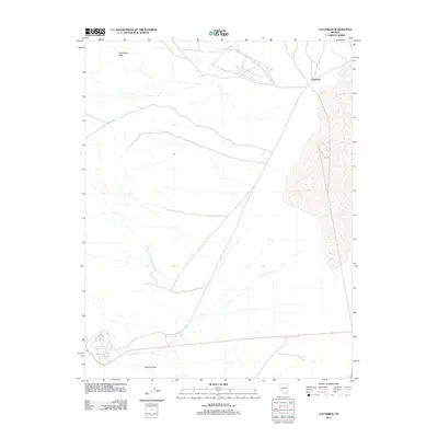
2011 Map of Columbus
USGS Topo · Published 2011About this map
The settlement of Columbus sits at the edge of a wide alkali flat in this 2011 survey, a landscape defined by the stark contrasts of the high desert. To the north and south, the terrain rises into the Candelaria Hills and the Volcanic Hills, providing a rugged backdrop to the drainage systems of the region. Pinchot Creek snakes across the southern portion of the quadrangle, tracing a path through the arid lowlands before reaching the expansive dry lake bed. The map reveals the intricate network of unimproved roads and trails that crisscross the area, reflecting a long history of activity in this mineral-rich portion of Esmeralda County. While the settlement at Columbus remains a focal point, the surrounding topography underscores the isolation and specialized nature of human presence in this corner of the Great Basin.
Find a feature on this map
4 named features on this map. Tap any name to fly to it.
Don’t see what you’re looking for? This feature index may not catch every label — zoom into the map to look around manually.
Map Details
Editions of this 2011 Columbus Map
This is the sole edition of this map. No revisions or reprints were ever made.
Other maps of this area

1898 · Silver Peak
USGS Topo · 1:125,000

1900 · Silver Peak
USGS Topo · 1:125,000

1907 · Tonopah
USGS Topo · 1:250,000

1908 · Lida
USGS Topo · 1:250,000

1908 · Tonopah
USGS Topo · 1:250,000

1909 · Hawthorne
USGS Topo · 1:250,000

1911 · Hawthorne
USGS Topo · 1:250,000

1913 · Lida
USGS Topo · 1:250,000

1915 · Hawthorne
USGS Topo · 1:250,000

1917 · White Mountain
USGS Topo · 1:125,000