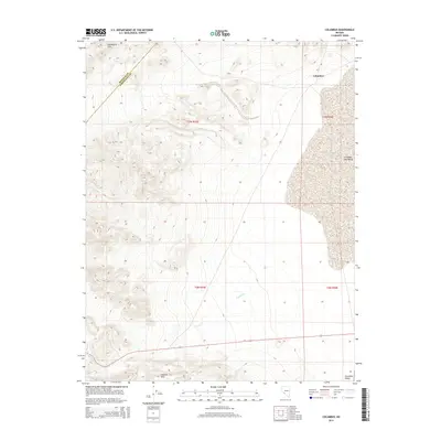
2014 Map of Columbus
USGS Topo · Published 2014About this map
Columbus Salt Marsh dominates the eastern expanse of this Esmeralda County landscape, a stark reminder of the region's ancient geological history. Situated along the boundary with Mineral County, the terrain is defined by the Candelaria Hills to the northwest and the Volcanic Hills to the south. The modest settlement of Columbus sits on the edge of the basin, while the ephemeral Pinchot Cr drains into the Columbia Valley at the southern edge of the survey. This 2014 mapping provides a modern look at a classic Nevada desert basin, illustrating the stark topographic contrast between the high ridges of the surrounding ranges and the flat, mineral-rich salt pan. The presence of established county lines and township markers helps researchers orient these natural features within the larger legal and political grid of the Great Basin.
Find a feature on this map
7 named features on this map. Tap any name to fly to it.
Don’t see what you’re looking for? This feature index may not catch every label — zoom into the map to look around manually.
Map Details
Editions of this 2014 Columbus Map
This is the sole edition of this map. No revisions or reprints were ever made.
Other maps of this area

1898 · Silver Peak
USGS Topo · 1:125,000

1900 · Silver Peak
USGS Topo · 1:125,000

1907 · Tonopah
USGS Topo · 1:250,000

1908 · Lida
USGS Topo · 1:250,000

1908 · Tonopah
USGS Topo · 1:250,000

1909 · Hawthorne
USGS Topo · 1:250,000

1911 · Hawthorne
USGS Topo · 1:250,000

1913 · Lida
USGS Topo · 1:250,000

1915 · Hawthorne
USGS Topo · 1:250,000

1917 · White Mountain
USGS Topo · 1:125,000