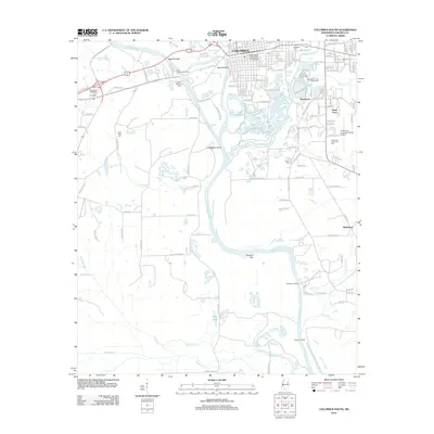
2012 Map of Columbus South
USGS Topo · Published 2012About this map
Columbus anchors the northern edge of this landscape, where the Tombigbee River winds through a complex network of wetlands and river landings. The presence of Old Westport Landing, Charter Landing, and Beckwiths Landing highlights the enduring importance of the river corridor for commerce and transit south of the city. To the east, the Mississippi University for Women and the Lowndes County Fairgrounds mark the edge of urban development as it transitions into the smaller clusters of Pinehaven and Dean Acres.
Find a feature on this map
143 named features on this map. Tap any name to fly to it.
Don’t see what you’re looking for? This feature index may not catch every label — zoom into the map to look around manually.
Map Details
Editions of this 2012 Columbus South Map
This is the sole edition of this map. No revisions or reprints were ever made.
Other maps of this area

1953 · West Point
USGS Topo · 1:250,000

1958 · West Point
USGS Topo · 1:250,000

1959 · Artesia
USGS Topo · 1:62,500

1959 · West Point
USGS Topo · 1:62,500

1960 · Caledonia
USGS Topo · 1:62,500

1960 · Columbus
USGS Topo · 1:62,500

1963 · West Point
USGS Topo · 1:250,000

1982 · West Point
USGS Topo · 1:100,000

1984 · West Point
USGS Topo · 1:250,000
1987 · Columbus North
USGS Topo · 1:24,000