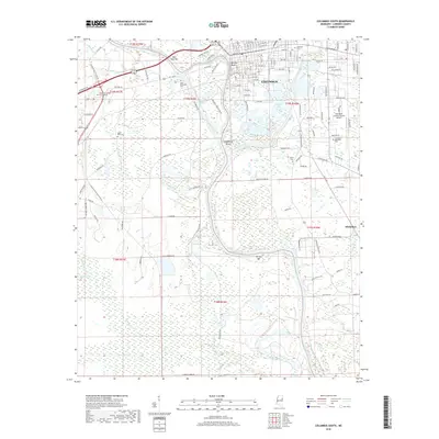
2018 Map of Columbus South
USGS Topo · Published 2018About this map
Columbus serves as the focal point of this Lowndes County survey, situated where the Tombigbee River meets the intricate wetlands and bends of the southern Mississippi landscape. The river dominates the western and southern reaches of the map, characterized by distinct features like West Port Bar, Butlers Bar, and the notable elevation of Bartons Bluff. To the east, the convergence of Luxapallila Creek and its associated Luxapallila Shoal highlights the historical importance of these waterways for navigation and early industry.
Find a feature on this map
123 named features on this map. Tap any name to fly to it.
Don’t see what you’re looking for? This feature index may not catch every label — zoom into the map to look around manually.
Map Details
Editions of this 2018 Columbus South Map
This is the sole edition of this map. No revisions or reprints were ever made.
Other maps of this area

1953 · West Point
USGS Topo · 1:250,000

1958 · West Point
USGS Topo · 1:250,000

1959 · Artesia
USGS Topo · 1:62,500

1959 · West Point
USGS Topo · 1:62,500

1960 · Caledonia
USGS Topo · 1:62,500

1960 · Columbus
USGS Topo · 1:62,500

1963 · West Point
USGS Topo · 1:250,000

1982 · West Point
USGS Topo · 1:100,000

1984 · West Point
USGS Topo · 1:250,000
1987 · Columbus North
USGS Topo · 1:24,000