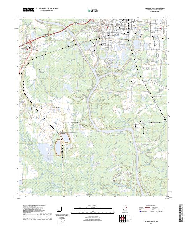
2024 Map of Columbus South
USGS Topo · Published 2024About this map
Columbus serves as the central hub of this Mississippi landscape, where the historic Lowndes County Courthouse and the Mississippi University for Women anchor the northern reaches of the sheet. The town is defined by its relationship with the Tombigbee River, which here includes the engineered Tombigbee River - Tennessee-Tombigbee Waterway and the distinctive Columbus Cutoff. This waterway serves as a major industrial and transit corridor, shaped by features like West Port Bar and Bartons Bluff.
Find a feature on this map
148 named features on this map. Tap any name to fly to it.
Don’t see what you’re looking for? This feature index may not catch every label — zoom into the map to look around manually.
Map Details
Editions of this 2024 Columbus South Map
This is the sole edition of this map. No revisions or reprints were ever made.
Other maps of this area

1953 · West Point
USGS Topo · 1:250,000

1958 · West Point
USGS Topo · 1:250,000

1959 · Artesia
USGS Topo · 1:62,500

1959 · West Point
USGS Topo · 1:62,500

1960 · Caledonia
USGS Topo · 1:62,500

1960 · Columbus
USGS Topo · 1:62,500

1963 · West Point
USGS Topo · 1:250,000

1982 · West Point
USGS Topo · 1:100,000

1984 · West Point
USGS Topo · 1:250,000
1987 · Columbus North
USGS Topo · 1:24,000