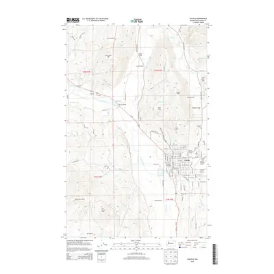
2014 Map of Colville
USGS Topo · Published 2014About this map
Colville serves as the regional hub of the Colville Valley, situated where the BNSF Railway and Us-395 intersect the natural corridor of the Colville River. The landscape is defined by the transition from the broad agricultural flats of Garrison Flat to the prominent heights of Colville Mtn, Eagle Peak, and Rattlesnake Mtn. This 2014 survey documents a mature civic infrastructure, including the Northeast Washington Fairgrounds, the Colville Municipal Airport, and the Elks Lodge and Golf Course.
Find a feature on this map
105 named features on this map. Tap any name to fly to it.
Don’t see what you’re looking for? This feature index may not catch every label — zoom into the map to look around manually.
Map Details
Editions of this 2014 Colville Map
This is the sole edition of this map. No revisions or reprints were ever made.
Other maps of this area

1927 · Chewelah
USGS Topo · 1:125,000

1929 · Colville
USGS Topo · 1:125,000

1930 · Chewelah
USGS Topo · 1:125,000

1933 · Colville
USGS Topo · 1:125,000

1936 · Marcus
USGS Topo · 1:96,000

1942 · Marcus
USGS Topo · 1:125,000

1948 · Kettle Falls
USGS Topo · 1:62,500

1950 · Inchelium
USGS Topo · 1:62,500

1951 · Kettle Falls
USGS Topo · 1:62,500

1952 · Gillette Mtn
USGS Topo · 1:24,000