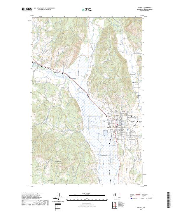
2023 Map of Colville
USGS Topo · Published 2023About this map
Colville serves as the regional hub for the Colville Valley at the foot of the Huckleberry Range. This survey documents the modern layout of the city, including its civic core around the Stevens County Courthouse and the local education center at Spokane Community College Colville. The surrounding geography is defined by a series of low peaks like Colville Mtn and Old Town Mtn, and the nearby settlements of Pinkney City and Garrison Flat. Along the northeastern edge, Mill Creek flows toward Douglass Falls, while several cemeteries including Mountain View Cem and Highland Cem provide essential locations for genealogical research. The map also traces the path of Highway 395 and identifies an Old Abandoned Hwy, reflecting shifts in the local transportation network over time.
Find a feature on this map
112 named features on this map. Tap any name to fly to it.
Don’t see what you’re looking for? This feature index may not catch every label — zoom into the map to look around manually.
Map Details
Editions of this 2023 Colville Map
This is the sole edition of this map. No revisions or reprints were ever made.
Other maps of this area

1927 · Chewelah
USGS Topo · 1:125,000

1929 · Colville
USGS Topo · 1:125,000

1930 · Chewelah
USGS Topo · 1:125,000

1933 · Colville
USGS Topo · 1:125,000

1936 · Marcus
USGS Topo · 1:96,000

1942 · Marcus
USGS Topo · 1:125,000

1948 · Kettle Falls
USGS Topo · 1:62,500

1950 · Inchelium
USGS Topo · 1:62,500

1951 · Kettle Falls
USGS Topo · 1:62,500

1952 · Gillette Mtn
USGS Topo · 1:24,000