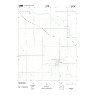
2009 Map of Colwich
USGS Topo · Published 2009About this map
Colwich serves as the primary center of activity in this Sedgwick County landscape, appearing here just before the end of the decade. The town's grid is clearly defined, anchored by the Colwich Post Office and bordered by thoroughfares like Breese St and E Union Ave. The surrounding area is marked by a network of sectional roads and the diagonal path of the W K 96 Hwy, which cuts across the terrain toward the northwest.
Find a feature on this map
25 named features on this map. Tap any name to fly to it.
Don’t see what you’re looking for? This feature index may not catch every label — zoom into the map to look around manually.
Map Details
Editions of this 2009 Colwich Map
This is the sole edition of this map. No revisions or reprints were ever made.
Other maps of this area

1889 · Cheney
USGS Topo · 1:125,000

1889 · Wichita
USGS Topo · 1:125,000

1891 · Cheney
USGS Topo · 1:125,000

1894 · Wichita
USGS Topo · 1:125,000

1901 · Cheney
USGS Topo · 1:125,000

1941 · Maize
USGS Topo · 1:31,680

1942 · Maize
USGS Topo · 1:31,680

1943 · Wichita West
USGS Topo · 1:31,680

1955 · Wichita
USGS Topo · 1:250,000
1956 · Maize
USGS Topo · 1:24,000