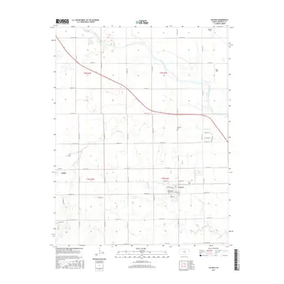
2015 Map of Colwich
USGS Topo · Published 2015About this map
The town of Colwich serves as a focal point in this 2015 survey of the Sedgwick County countryside, where the agricultural grid is intersected by the winding course of the Arkansas River and Big Slough. The landscape is defined by the steady progression of section-line roads, such as N 167th St W and W 53rd St N, which frame the local homesteads and regional infrastructure. Genealogists can identify significant local landmarks including the Sacred Heart Catholic Cem near the town center and the Eldridge Cem further north. Aviation footprints are visible through private airstrips like Roberts Field and Eagle Field, while the northwestern edge of the map captures the outskirts of Andale. The drainage patterns of Cowskin Cr weave through the township, illustrating the relationship between the prairie hydrology and the established road network of the mid-2010s.
Find a feature on this map
42 named features on this map. Tap any name to fly to it.
Don’t see what you’re looking for? This feature index may not catch every label — zoom into the map to look around manually.
Map Details
Editions of this 2015 Colwich Map
This is the sole edition of this map. No revisions or reprints were ever made.
Other maps of this area

1889 · Cheney
USGS Topo · 1:125,000

1889 · Wichita
USGS Topo · 1:125,000

1891 · Cheney
USGS Topo · 1:125,000

1894 · Wichita
USGS Topo · 1:125,000

1901 · Cheney
USGS Topo · 1:125,000

1941 · Maize
USGS Topo · 1:31,680

1942 · Maize
USGS Topo · 1:31,680

1943 · Wichita West
USGS Topo · 1:31,680

1955 · Wichita
USGS Topo · 1:250,000
1956 · Maize
USGS Topo · 1:24,000