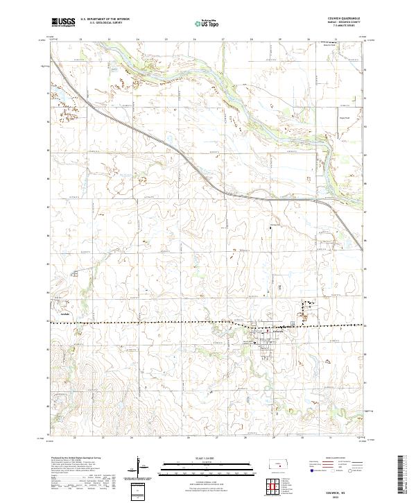
2022 Map of Colwich
USGS Topo · Published 2022About this map
Colwich and Andale anchor this Sedgwick County landscape, where the agricultural grid is defined by a network of local waterways. The Arkansas River winds through the northern sections, accompanied by the distinct drainage patterns of Big Slough, S Fork Big Slough, and Cowskin Cr. This territory is marked by legacy landmarks like the Sacred Heart Catholic Cem and Eldridge Cem, which provide essential points of reference for local family history and genealogy.
Find a feature on this map
33 named features on this map. Tap any name to fly to it.
Don’t see what you’re looking for? This feature index may not catch every label — zoom into the map to look around manually.
Map Details
Editions of this 2022 Colwich Map
This is the sole edition of this map. No revisions or reprints were ever made.
Other maps of this area

1889 · Cheney
USGS Topo · 1:125,000

1889 · Wichita
USGS Topo · 1:125,000

1891 · Cheney
USGS Topo · 1:125,000

1894 · Wichita
USGS Topo · 1:125,000

1901 · Cheney
USGS Topo · 1:125,000

1941 · Maize
USGS Topo · 1:31,680

1942 · Maize
USGS Topo · 1:31,680

1943 · Wichita West
USGS Topo · 1:31,680

1955 · Wichita
USGS Topo · 1:250,000
1956 · Maize
USGS Topo · 1:24,000