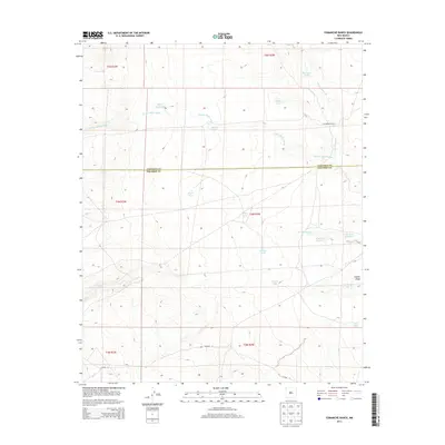
2013 Map of Comanche Ranch
USGS Topo · Published 2013About this map
Comanche Ranch sits in a high-desert environment where the management of water is central to the landscape's layout. This area, straddling the Valencia and Socorro County line, is defined by an intricate network of drainages and seasonal water catchments. The terrain is carved by the Arroyo Monte Largo and the winding Arroyo Comanche, which feed into the broader Coyote Draw. These natural features are supplemented by numerous man-made livestock tanks and natural springs, such as Coyote Spring and Heredura Tank. The presence of specialized catchments like Click Tank Number 7 and Lost Spring Tank illustrates the ranching infrastructure required to sustain life and industry in this arid region of New Mexico. Aside from Co Road 12, the area remains sparsely developed, reflecting its character as active rangeland.
Find a feature on this map
27 named features on this map. Tap any name to fly to it.
Don’t see what you’re looking for? This feature index may not catch every label — zoom into the map to look around manually.
Map Details
Editions of this 2013 Comanche Ranch Map
This is the sole edition of this map. No revisions or reprints were ever made.
Other maps of this area

1916 · La Joya
USGS Topo · 1:125,000

1917 · Cerro Verde
USGS Topo · 1:125,000

1952 · La Joya NW
USGS Topo · 1:24,000

1952 · Belen SW
USGS Topo · 1:24,000

1952 · Belen NW
USGS Topo · 1:24,000

1954 · Socorro
USGS Topo · 1:250,000

1956 · Mesa Aparejo
USGS Topo · 1:62,500

1958 · Socorro
USGS Topo · 1:250,000

1959 · Riley
USGS Topo · 1:62,500

1962 · Socorro
USGS Topo · 1:250,000