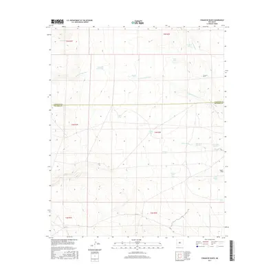
2017 Map of Comanche Ranch
USGS Topo · Published 2017About this map
Comanche Ranch sits at the center of this arid landscape, straddling the boundary between Valencia and Socorro Counties. The terrain is defined by a series of significant drainages, including the Arroyo Comanche, Arroyo Monte Largo, and Arroyo Alamito, which cut through the high plains. Water management is a primary feature of the local topography, evidenced by a dense network of catchment tanks such as Middle Tank, Bryce Tank, and the Click Tank Number 1 and Click Tank Number 2 pair. These features, along with Coyote Spring and Coyote Draw, illustrate the critical importance of water infrastructure for ranching operations in this high-altitude New Mexico environment. Local transit is limited primarily to Co Rd 12 in the southern portion of the quadrangle.
Find a feature on this map
27 named features on this map. Tap any name to fly to it.
Don’t see what you’re looking for? This feature index may not catch every label — zoom into the map to look around manually.
Map Details
Editions of this 2017 Comanche Ranch Map
This is the sole edition of this map. No revisions or reprints were ever made.
Other maps of this area

1916 · La Joya
USGS Topo · 1:125,000

1917 · Cerro Verde
USGS Topo · 1:125,000

1952 · La Joya NW
USGS Topo · 1:24,000

1952 · Belen SW
USGS Topo · 1:24,000

1952 · Belen NW
USGS Topo · 1:24,000

1954 · Socorro
USGS Topo · 1:250,000

1956 · Mesa Aparejo
USGS Topo · 1:62,500

1958 · Socorro
USGS Topo · 1:250,000

1959 · Riley
USGS Topo · 1:62,500

1962 · Socorro
USGS Topo · 1:250,000